Korte (Municipality of Izola)
The village of Korte, in the center of the Izola's countryside, hides many interesting stories about the life of our ancestors. They co-created life in the Istrian landscape 7,000 years ago. Numerous archeological remains tell us about their achievements, among which the bronze figurine of the dog "Kašlerski gonič", from the Late Iron Age from the nearby hillfort of Kaštelir near Korte, is worth mentioning. With the project Kaštelir, the hillfort and its surroundings acquired new interpretive content.
Korte and its surroundings, results and outputs of the project Kaštelir:
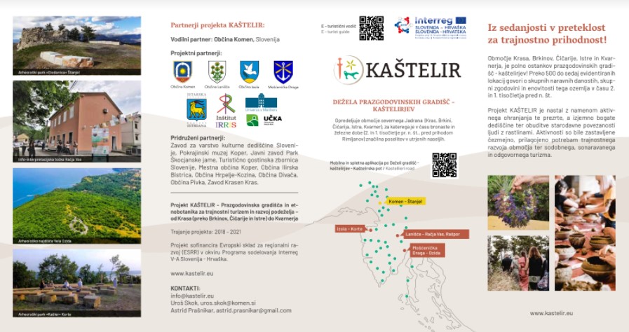
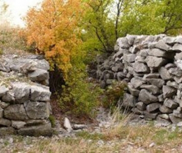
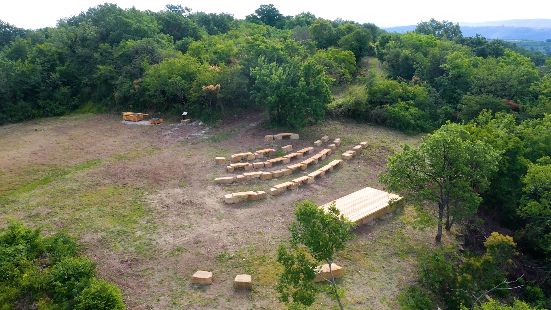
- ARCHAEOLOGICAL PARK ''KAŠLER'' with arranged paths, didactic boards, drywalls, small Istrian house, arranged outdoor classroom, benches, two archeological sandboxes, stage and photographic frame offers you the unforgettable exploration of the discovered archeological heritage and a beautiful view of the Piran Bay, Adriatic Sea and Šavrinska Hill;
- INFO POINT IN THE ZADRUŽNI DOM KORTE represents the starting points for guided and independent tours of the archeological park with a timeline that takes us through the period of prehistory;
- ORIGINAL TOURIST SOUVENIRS, exhibited in the info point in the Zadružni dom Korte, based on the model of prehistoric findings and a touch of contemporary creative ideas, represent the work of local artists;
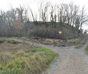
- SHORT BOTANICAL PATH from the village of Korte to Kaštelir leads through forest communities surrounded by drywalls, and past dry habitats, vineyards and olive groves;
- LONG BOTANICAL PATH AROUND KORTE, through typical habitats such as grasslands, vineyards and fields, offers a tour of the Istrian landscape with many smaller watercourses, which made life easier for locals in dry summer days.
Archaeological cycling routes
- BETWEEN THE KARST EDGE AND THE SEA with a starting point in Socerb, past Hrastovlje to Kaštelir near Korte above Izola, it offers an introduction to the hillforts of Slovenian Istria. The demanding cycling route is 101.4 km long with 1950 m of ascent and descent (https://map.kastelir.eu/sl/kastelir-road);
- The cross-border route FROM KAŠTELIR TO KAŠTELIR starts at the hillfort Kaštelir near Korte above Izola, continues past the Piran salt pans, crosses the national border at the Dragonja river and past the village of Kaštel, the Kaštelir hillfort near Nova vas and the archeological site of Sv. Martin in Tarska vala, and ends near Poreč. The moderately demanding route is 52 km long with 390 m of ascent, and 580 m of descent (https://map.kastelir.eu/sl/kastelir-road).
Leaflet
Korte above Izola - The Prehistoric Hillfort Kaštelir, Dvori above Izola, Corte d'Isola, Kaštelir near Čedlje, Castelliere, Kašler in the Local Dialect
Time period: Late Neolithic, Iron Age, early Roman period
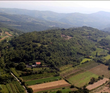
With its 1230 meters, Kaštelir above Korte near Izola is one of the largest prehistoric settlements in the Slovene part of Istria. The territory of the settlement occupies the outermost south elevation of a long ridge that stretches from Malija to Korte, that is, goes between Izola and Sečovlje and dominates the landscape above the village of Korte situated at 271 m above sea level.
Kaštelir is one of the biggest hillforts in the coastal part of the Šavrini hills and undoubtedly used to be the central, i.e., main settlement in the wider area. Kaštelir is visually connected to smaller forts that might have been used as defensive outposts between the sea and inland territory.
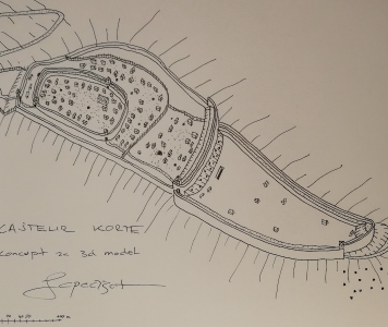
The settlement that was inhabited from the Late Neolithic until the Roman period, that is, about 5000 years, is divided into the so-called main town or acropolis and lower town. Its outermost eastern part is protected by a stone defensive embankment. The acropolis was protected in the same way with walls in its outermost eastern part, which are today shaped like a stone embankment. The other parts of the settlement were protected by a steep slope. Prominent members of the community of the time, who performed secular and occult activities, lived in the acropolis. Blacksmith workshops were usually located in front of the entrance to the acropolis. The lower town was built of simple houses with dry stone foundations, while the houses in the upper town were built from plastered clay and had gable roofs. Some houses had cellars as well. Below the acropolis, there were stables for animals and probably arable land.
The discovery of a bronze dog figurine from the Late Iron Age indicates that there used to be a sanctuary in the area. The lower town was used by the rest of the inhabitants, who kept their livestock in stables and pens. Numerous natural resources inside and around the settlement and fertile land enabled the settlement to be self-sustainable for thousands of years.
A cemetery was built on the territory of the fort in the early Roman period.
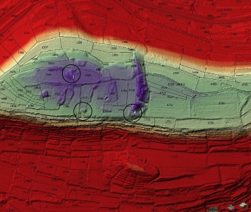
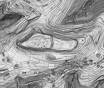 Representation on an SVF Digital Relief Model (LiDAR, Source: The Register of Slovene Cultural Heritage, RKD)
 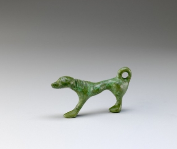 A Bronze Dog Figurine, Developed Iron Age 4th–3rd Century BC, Kept at the Koper Regional Museum, Photo by T. Lauko