Mošćenička Draga – Vela Ozida (Municipality of Mošćenička Draga)
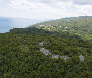
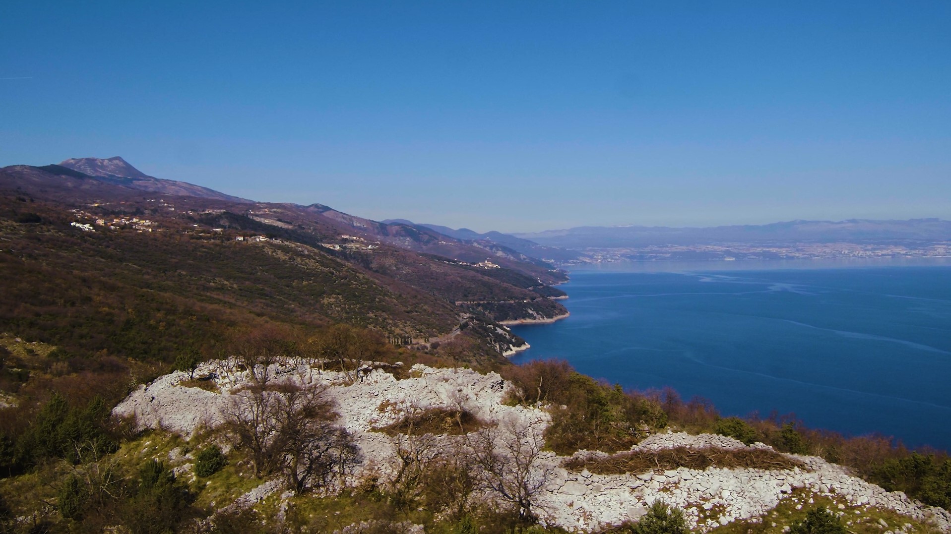
The landscape above Kvarner, with the medieval settlements of Brseč and Mošćenice, hides many stories from prehistoric times. In addition to the hillforts of Brseč and Mošćenice, it is worth mentioning the archeological site on the hill above Brseč – Vela Ozida with the prehistoric dry stone wall defense structure. As part of the Kaštelir project, the archeological site received new contents and a tourist offer.
Mošćenička Draga and Vela Ozida, results and outputs of the project Kaštelir:
- ARCHAEO-BOTANICAL PARK IN MOŠĆENIČKA DRAGA WITH CONNECTION TO THE VELA OZIDA ARCHAEOLOGICAL SITE, in which the importance of the biodiversity of the surrounding landscape and the importance of edible wild plants, which were once indispensable companions of ancient times, are highlighted. From the park to the site, visitors can go along the LONG BOTANICAL PATH, where they can get acquainted with the botany and ethnobotany of the area via online content (https://map.kastelir.eu/sl/botanical-paths);
- INFO-INTERPRETATION POINT IN THE TOURIST ORGANISATION IN MOŠĆENIČKA DRAGA for guided and independent tours of the surrounding hillforts and the Vela Ozida prehistoric dry stone wall defense structure;
- SHORT BOTANICAL PATH that leads through a landscape with dry stone walls, occasional watercourses and varied habitats from the town of Brseč to the end point of Vela Ozida. The arranged hiking trail to the oval-shaped dry stone wall is upgraded with INFORMATION BOARDS that take you into the prehistoric past of this area and reveal the story of a mysterious Iron Age people - the Liburnians. After the Roman occupation, the region was called Liburnia (https://map.kastelir.eu/en/botanical-paths).
Archaeological cycling route
- THE CYCLING ROUTE - WITH A VIEW OF KVARNER starts in the town of Labin, leads along side roads to the port of Plomin, to Cape Mašnjak and along the coast - with a view of Kvarner, continues past Brseč to the fort of Vela Ozida and on to Mošćenice. From here, the route turns back to the interior of Istria and ends at the archeological site Stari Lupoglav. The demanding cycling route is 71.4 km long, with 1720 m of ascent and 1530 m of descent. (https://map.kastelir.eu/sl/kastelir-road).
Leaflet
Vela Ozida Prehistoric Dry Stone Wall Defense Structure
Time period: Prehistoric times
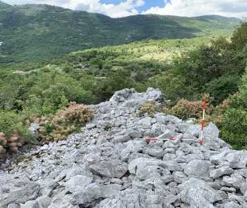
An impressive circular stone mound on a hill 224 meters above sea level is an interesting site of unknown purpose. Its shape, construction technique, and pottery fragments suggest it dates back to prehistoric times. Its high position above Kvarner on a hill separated from Marin Breg Hill near Golovik by a saddle of fertile land and good visual communication in the direction of Brseč and Mošćenice suggest it might have been an important guarding and communication point. The stone ring of impressive size, which was probably formed by collapsed walls (55 x 35 m) enclosing the inner area (32 x 20 m), might have been a small guard post with a protruding additional space (20 x 11 m) on the southern side which was connected to the main embankment. When we consider the role of this site, we must not neglect the possibility of the existence of a grave shaped like a tumulus where an important member of one of the communities that lived in the vicinity was buried. Several dry stone wall structures are visible on the south slope. Modern dry stone walls descend radially from the top enclosing plots belonging to different owners.
In the entire area toward Golovik, there are small terraced plots of fertile land surrounded by dry stone walls, which creates a special landscape element.
Bibliography: Buršić-Matijašić 2007, 357; Buršić-Matijašić 2012, 233.


